
New model may improve Bay Area seismic hazard maps, according to Stanford researchers
The Santa Cruz Mountains define the geography of the Bay Area south of San Francisco, protecting the Peninsula from the Pacific Ocean’s cold marine layer


clear sky
clear sky
clear sky
clear sky
The Santa Cruz Mountains define the geography of the Bay Area south of San Francisco, protecting the Peninsula from the Pacific Ocean’s cold marine layer

After Leland Stanford Jr. died in 1884, the Stanfords decided to build a university in his honor, the corner stone of which was laid in


A plaque placed on the south side of the Middlefield Road bridge by the City of Palo Alto in 1969 implies that a ford at

In 1888 Timothy Hopkins (1859-1936), the adopted son of Mary Hopkins, the otherwise childless widow of railroad builder Mark Hopkins, inherited Sherwood Hall, the massive

We've noticed lemonade stands sprouting all over Menlo Park this weekend, so it's not surprising that the warm weather would prompt some water play as

If you’re driving south on Alma Street in Menlo Park on a dark night after having drunk too much, you might be tempted to drive
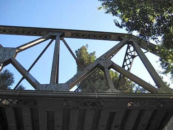
In the photo above, El Palo Alto looms above the Union Pacific Railroad Bridge that spans San Francisquito Creek. Built in 1902 when the original

San Mateo County was carved off from San Francisco County in 1856 soon after California became a state in 1848. The new county's southern boundary,

The bike/pedestrian bridge over the San Francisquito Creek at San Mateo Drive is sometimes known as the Ohlone-Menlo bridge since the Stanford side of the

Today Sand Hill Road crosses San Francisquito Creek over a modern four-lane, steel-reinforced concrete bridge built in 2004 to replace a 2-lane version built in


Please help support InMenlo! Your contribution will help us continue to bring InMenlo to you. Click on the button below to contribute!